Project information
- Name: UN Map of Afghanistan
- Creation date: 4th December, 2024
- Software: ArcGIS Pro, QGIS, Excel, FME Workbench
- Source: UNAMA Afghanistan, UN, Esri, Afghanistan Government
- Description: I compiled these maps based on the data provided by UNAMA Afghanistan as part of my volunteer assignment. The assignment was completed successfully.
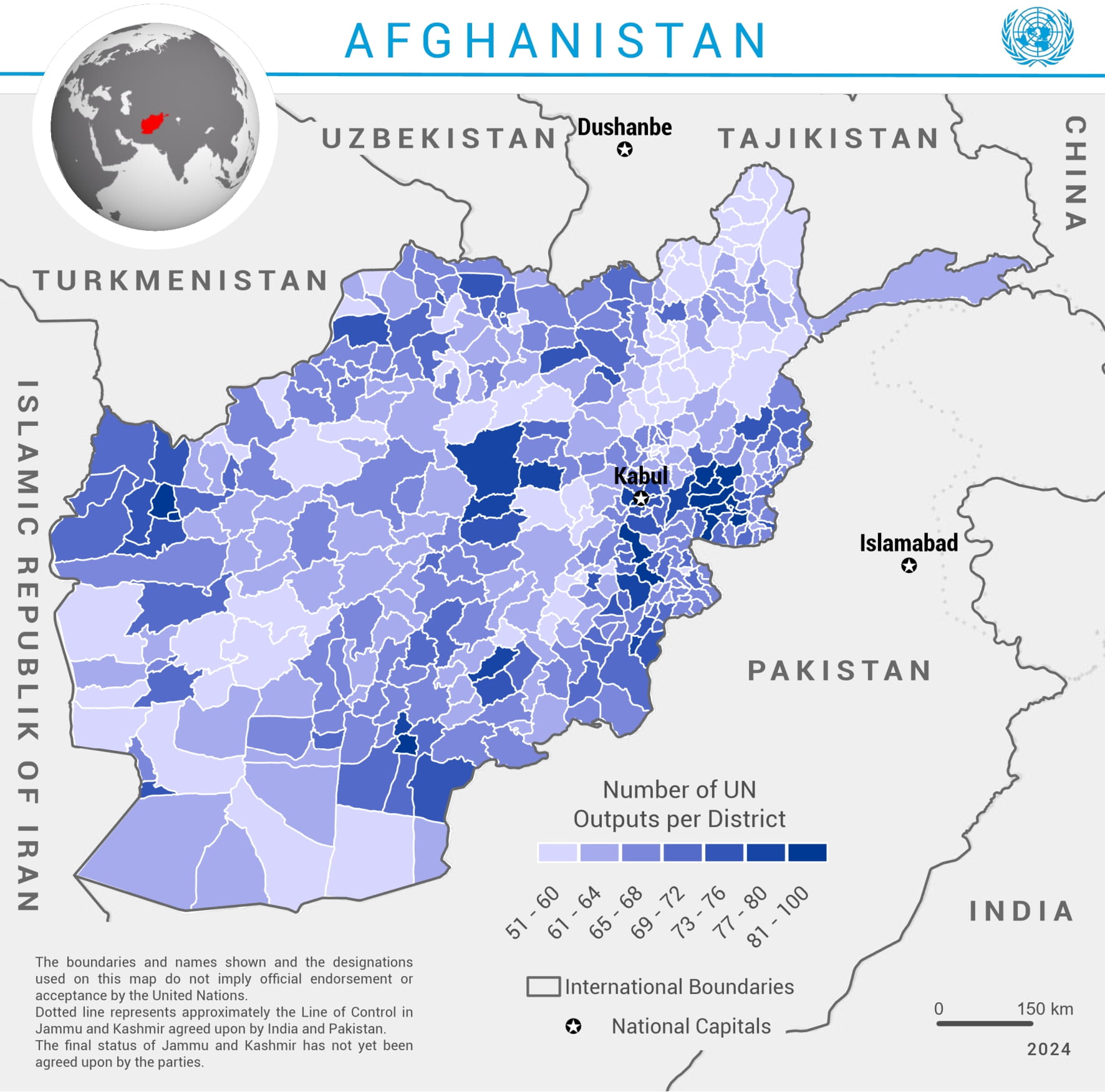
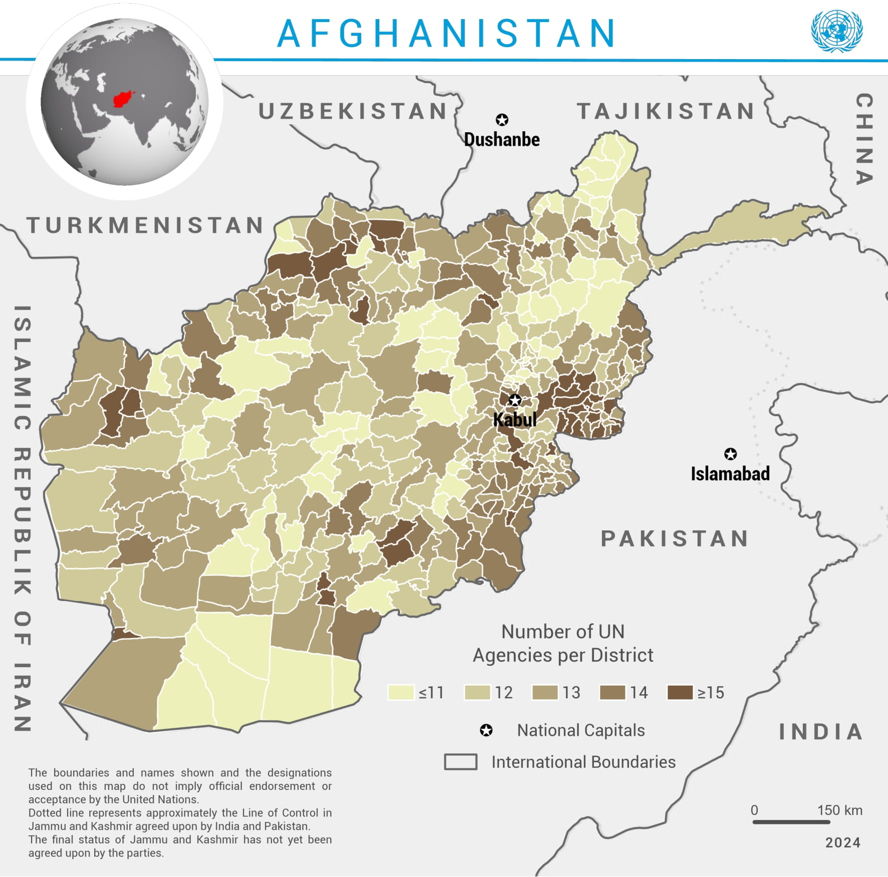
- The two maps provide a visual analysis of UN activities in Afghanistan at the district level. The first map depicts the number of UN agencies operating in each district, categorized into ranges, with darker shades indicating higher concentrations of agencies. The second map illustrates the number of UN outputs per district, similarly represented with darker tones for districts with more outputs.
- These maps highlight spatial patterns in the distribution of UN efforts, likely reflecting variations in needs, accessibility, and local priorities. The central region around Kabul shows higher densities of both agencies and outputs, indicating a focus on the capital and surrounding areas. Peripheral regions, especially near international borders, display diverse distributions, which may correlate with specific regional challenges or cross-border dynamics.


