Project information
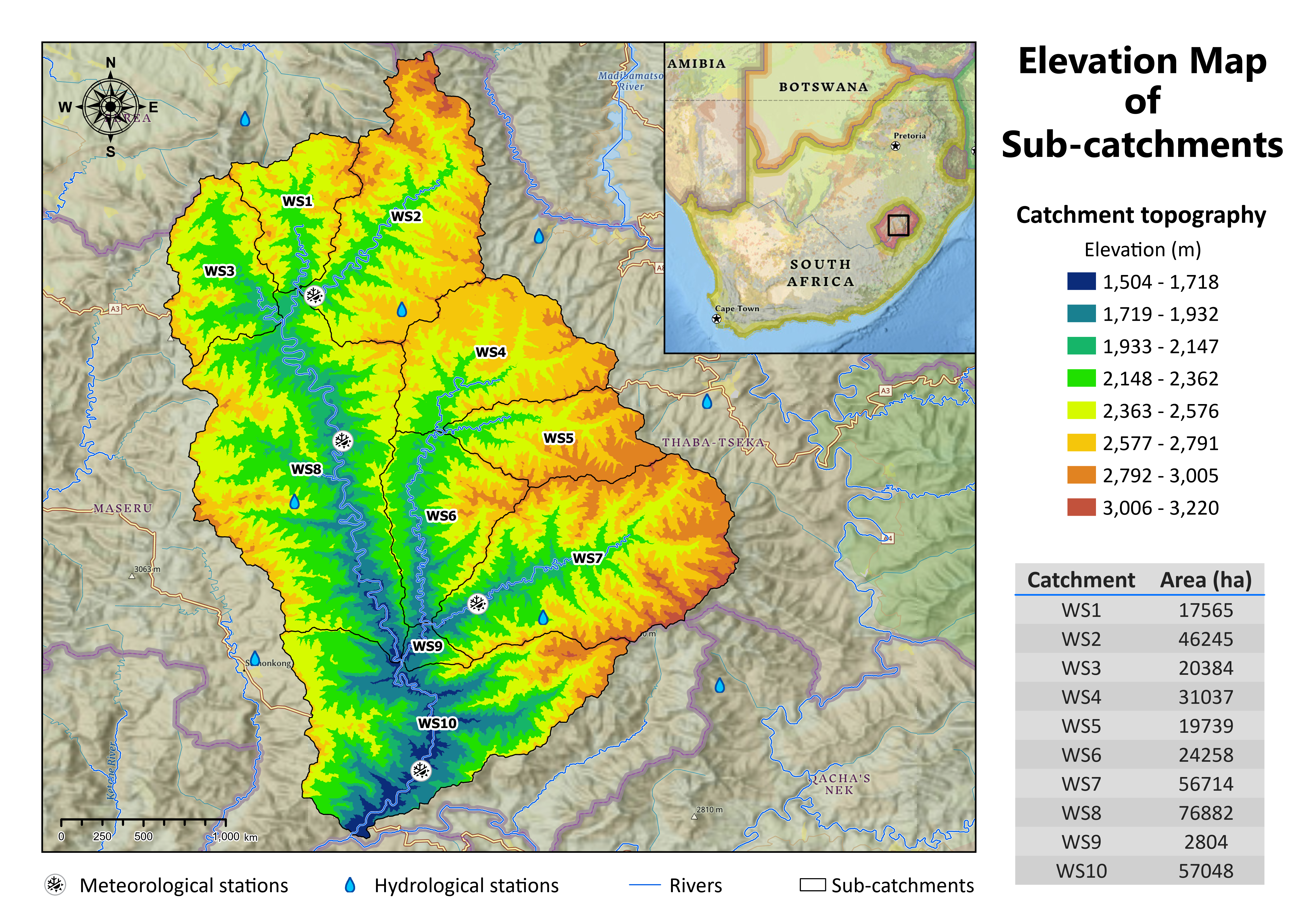
- Name: Elevation Map of Sub-catchments
- Creation date: 9th March, 2024
- Software: ArcGIS Pro
- Source: USGS, Esri Living Atlas
- Description: The elevation map of sub-catchments in the heart of Lesotho offers a comprehensive overview of the region's topographical variations. Each sub-catchment is delineated, highlighting the distinct contours and elevations within Lesotho's landscape.
