Project information
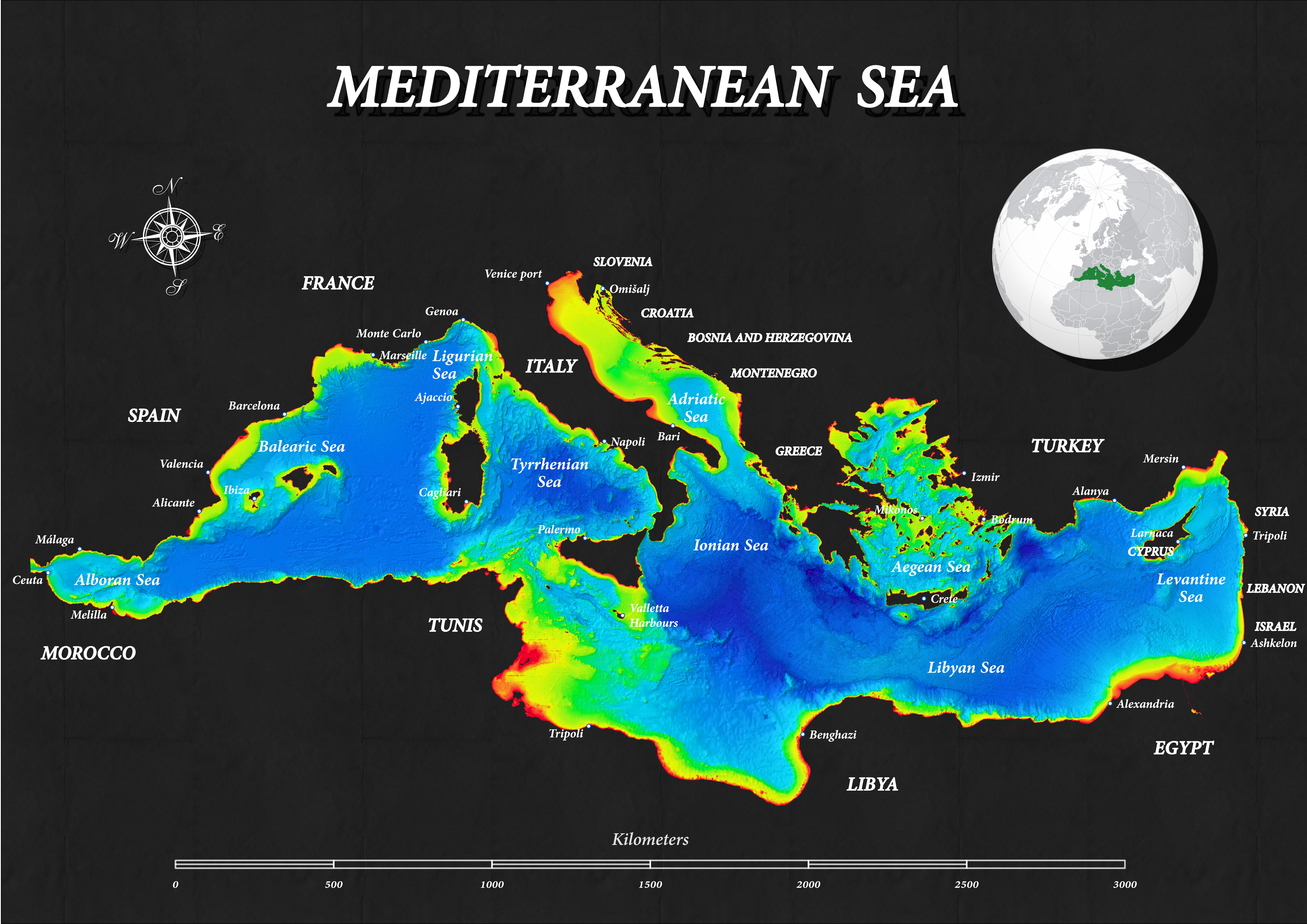
- Name: Mediterranean Sea
- Creation date: 30th September, 2024
- Software: ArcGIS Pro
- Source: ArcGIS Living Atlas, USGS, EMODnet, Marineregions
- Description: The map shows the bathymetry of the Mediterranean Sea and the geography of its largest and most critical ports. All internationally recognized internal seas are also highlighted.
