Project information
- Name: Turów coal mine
- Creation date: 8th May, 2023
- Software: ArcGIS Pro, Adobe Illustrator, Adobe Photoshop
- Source: ESA, USGS, Greenpeace, DW
- Description: The Turow mine is a large open-pit brown coal mine located in Poland, near the town of Bogatynia in the Lower Silesian Voivodeship. Opened in 1904, the Turow mine is one of the largest brown coal mines in Europe, annually extracting approximately 30 million tons of coal. Its operation has sparked controversy due to its impact on the local community and environment, including depletion of water resources and destruction of habitats for protected species.
- The Normalized Difference Vegetation Index (NDVI) is used to assess the health of vegetation, based on the analysis of light reflected from plants. This index indicates the degree of greenness and health of vegetation, allowing the determination of their condition and changes over time.
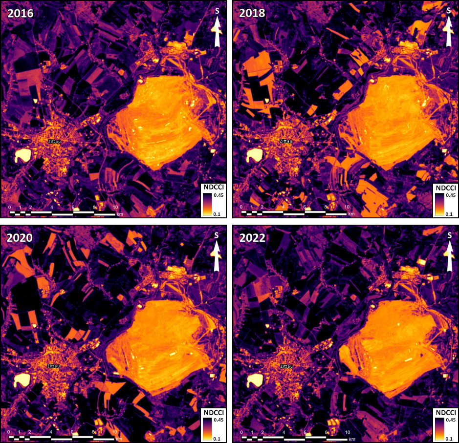
The Normalized Differential Concrete Condition Index (NDCCI) is utilized for monitoring the condition of concrete structures, based on the analysis of light reflected from the concrete surface. This index enables the identification and analysis of concrete deterioration and potential environmental risks associated with it.
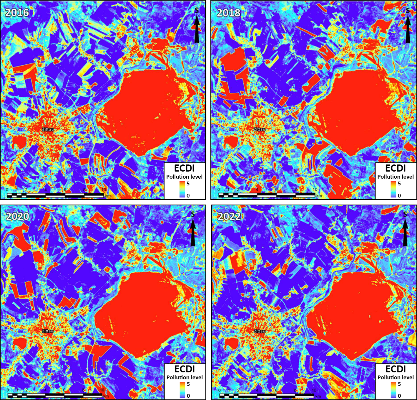
The Enhanced Coal Dust Index (ECDI) is a metric used to assess the presence and dispersion of coal dust in mining environments. By analyzing factors such as particle size distribution, moisture content, and airborne concentrations of coal dust, the ECDI provides valuable insights into the potential risks of coal dust explosion and respiratory hazards for workers. This index aids in monitoring and managing coal dust levels to enhance safety measures and mitigate the impact of coal dust-related incidents in mining operations.


