Project information
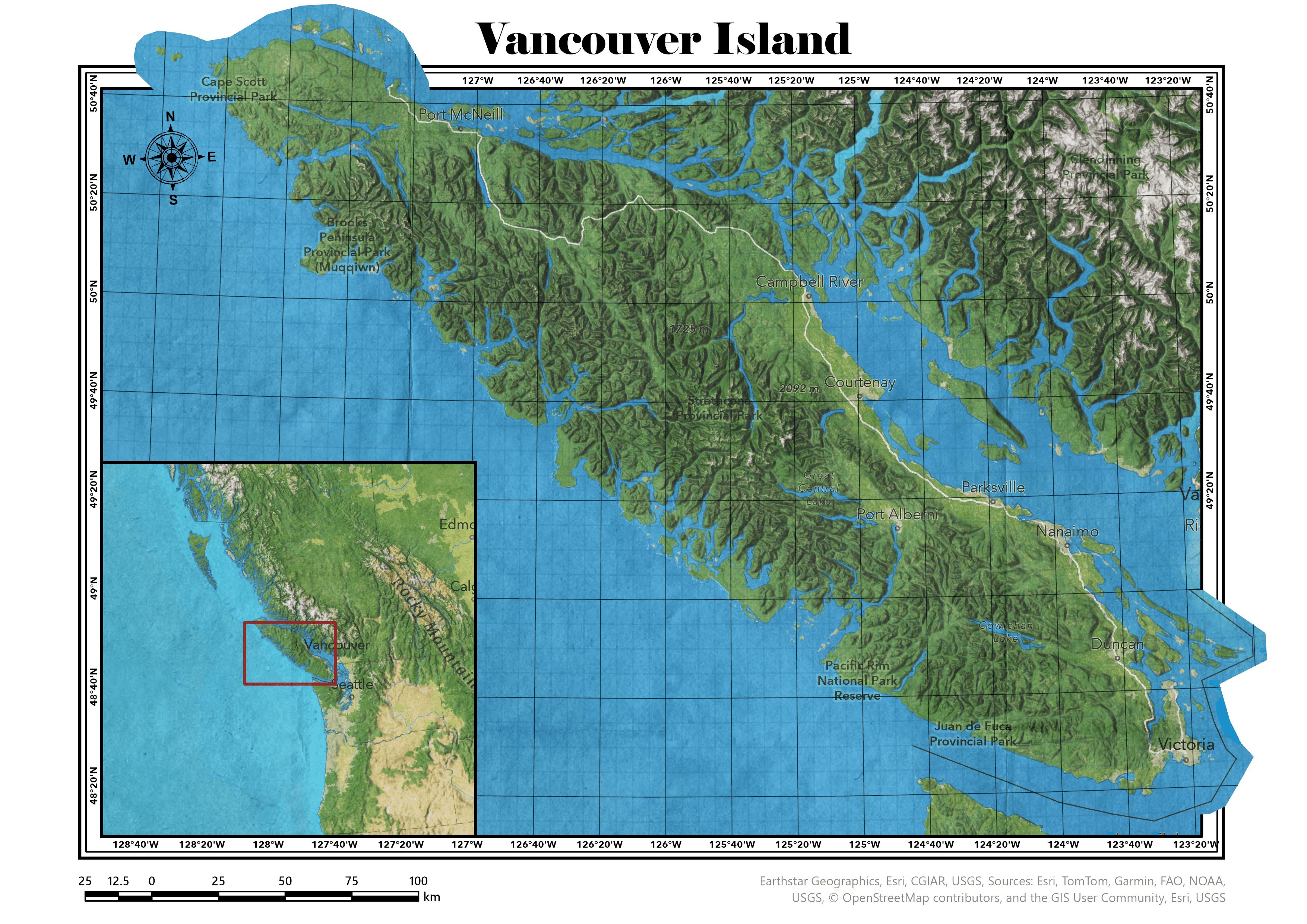
- Name: Vancouver Island
- Creation date: 20th March, 2024
- Software: ArcGIS Pro, Adobe Illustrator
- Source: USGS, Esri, NOAA, FAO
- Description: This is a physical map of Vancouver Island. I was inspired by the works of John Nelson. This time I learned some new tools and techniques and also experimented a lot with the design. I adore the geography of Vancouver Island and wish you to enjoy it as well.
